A Marine Management Organisation (MMO) report on spatial trends in shipping activity in the South Coast Marine Plan Area, authored by ABPmer, has recently been published.
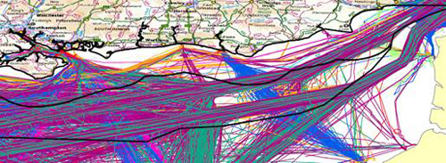
The MMO commissioned ABPmer to develop methods to analyse and display shipping activity using a national Automatic Identification System (AIS) dataset supplied by the Maritime and Coastguard Agency. The focus of the study was the creation of AIS derived products for marine planning to better consider shipping activity in decision-making.
Stephen Hull, Project Director said: "This was a really exciting project for ABPmer and represents a major breakthrough in the use and application of AIS data. While AIS data has been collected for a number of years, the potential of this data to inform and support marine decision-making has not previously been realised.
As a result of this study it is now possible to create useful spatial data products from raw AIS data which can inform marine planning, navigational risk assessments and marine licensing."
The report was published on 19 December 2013 as part of the Marine Management Organisation's marine evidence and information reports. It can be accessed from
http://www.marinemanagement.org.uk/evidence/1042.htm
ABPmer, a recognised thought leader in marine planning, has undertaken leading-edge research to support the development of integrated decision-making methodologies . It routinely uses national spatial data layers to support screening exercises and constraints mapping for decision making.