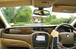
A new national street database providing details of low bridges, narrow roads and other restrictions could help to reduce satellite navigation errors. The National Street Gazetteer NSG lists over one million UK streets and is already widely used to help co ordinate roads works across England and Wales. It has been updated to a new format that enables Highways Authorities to record heights, weights and width restrictions, and directions one way or two way against individual roads and streets.
The new DTF 7.1 format, which is compliant with BS7666.2006, also enables closer alignment with the National Land and Property Gazetteer, the countrys definitive list of property addresses. Improving both the richness of the data held in the NSG and the data checking routines will enable those involved in road works to consult and co ordinate more effectively, reducing inconvenience and congestion.
Significantly the ability to record heights, weights, width restrictions relating to weak bridges, low bridges, or simply streets not wide enough for HGVs, now makes the NSG particularly useful to emergency services, transport firms and satellite navigation companies.
Roads and streets are part of the country's infrastructure and currently there are 1,127,730 of them listed in the NSG. Issues such as congestion, capacity planning, street works, accidents, incidents and maintenance can affect them all.
Uses could include command and control, routing, incident handling and risk assessment. In the absence of a suitable alternative the NSG could easily become the preferred source of definitive road information, providing recommended freight routes, motorway incident diversion routes and much more. The additional street data file (ASD) provides essential information, such as traffic sensitivity, bridges and structures, whilst closer alignment with the National Land and Property Gazetteer, already chosen for future fire incident mobilisation, makes its wider adoption more likely still.
"Highways Authorities collect and maintain road information routinely and the new DFT 7.1 format now enables this to be collected in a consistent and uniform manner across the country and takes into account the recent formation of nine new unitary authorities." said Martin Laker from Bath and North East Somerset Council, a member of the NSG Working Group. "Additionally this information will be available through the NSG hub making it a valuable national resource with ownership remaining with the creating authorities. As the NSG matures and becomes more than just a street works dataset it can start to be used for things like routing, both day-to-day and in the case of emergencies, something the Road Haulage Association are currently asking for," continued Laker.